
Proposed Territory of the Nueces Groundwater Conservation District
Understanding the Area Proposed for Local Groundwater Management
The proposed Nueces Groundwater Conservation District (GCD) would include areas of rural Nueces County, Texas, that are not currently within an existing groundwater conservation district.
The map accompanying this report highlights this region: the large white area represents the portion of Nueces County that presently lacks groundwater district coverage. It is the largest contiguous area in the region without local groundwater management or protection under a district framework.
Proposed boundaries include:
All rural areas of Nueces County located outside the city limits of Corpus Christi
All areas west of U.S. Highway 77 that lie within the city limits of Corpus Christi
Boundaries extending to the Nueces County line and adjoining the following established districts:
Corpus Christi Aquifer Storage and Recovery Conservation District
San Patricio County GCD
Brush Country GCD
Kenedy County GCD
This proposed boundary ensures that all unserved portions of Nueces County—particularly those in rural and agricultural regions—would be brought under locally guided groundwater management consistent with Chapter 36 of the Texas Water Code.
The purpose of defining this area is to ensure fair representation and consistent stewardship of the county’s shared groundwater resources, while maintaining clear coordination with neighboring districts and regional water management entities.
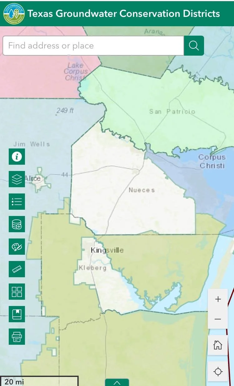
The white area on the map represents the portion of Nueces County not currently within a Groundwater Conservation District. This proposed territory includes all rural areas outside the Corpus Christi city limits, as well as areas west of U.S. Highway 77 within the city. The proposed district would be bounded by the Nueces County line and the existing Corpus Christi Aquifer Storage and Recovery Conservation District, San Patricio GCD, Brush Country GCD, and Kenedy GCD.